A standard guideline proposal
An essential assessment of the current state of land degradation
12-demo39_41928
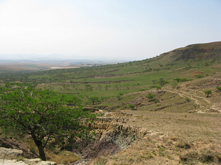
Land degradation has sharply increased over the last 60 years, in both developed and developing countries, because of population growth and industrial development. Fighting this process is now a priority, particularly in developing countries, which host 75% of the World’s population and where three out of four people work in agriculture. Restoring degraded land is expensive–at least 100-fold more costly than prevention. In order to prevent land degradation, it is essential to first evaluate the current land degradation status and the underlying causes. So far the main obstacle to achieving such evaluations has been the lack of a standard streamlined international assessment procedure.
A simple method for assessing human-induced land degradation
This method is used to evaluate and map the current state and causes of land degradation. It can be applied at different levels, ranging from the farm to an entire country. This streamlined procedure can be implemented in different regions, but is most tailored to tropical and subtropical regions. It has been successfully used at a national level (Togo) in Africa and at a provincial level (Vietnam) in Asia.
A map of the land degradation status has thus been developed, which is simple to use and understand by non-scientists. This map is based on a single composite land degradation index. It is also accompanied by a database managed via a geographical information system (GIS) that contains all data required to draw up and make effective use of this map.
This method consists of three phases:
In the laboratory: processing of available data on the natural environment and socioeconomic setting (maps, archives, statistics, field data, etc.) These data highlight physiographic units* within the study area, which then form polygons** when plotted on a topographical map. Each unit may therefore be made up of one or several polygons dispersed throughout the target area. Aerial and satellite images are also processed to obtain an even more precise delineation according to the land-use pattern. At the end of this phase, a provisional polygon-based map is drawn up of the study area.
In the field: identification of three indicators in preselected test sites within the polygons. These indicators are: the degradation type, extent and intensity. Six complementary variables are also determined: degradation rate, trend, history, causes, soil vulnerability and off-site effects. Each polygon defined in phase 1 is characterised by these three indicators, in addition to its physical and socioeconomic characteristics, and land-use patterns
In the laboratory: calculation of the composite land degradation index for each polygon according to the three main indicators (cf. following paragraph). This index is noted within each polygon on the provisional map and used to draw up the final map. The result is a land zoning map and database. Each zone represented by a polygon is characterised by a 1 to 5 colour scale indicating the degree of land degradation. Information on the indicators and the physiographic features of all polygons is stored in a separate database.
An area of land having the same type of landscape, geological substrata, soil, climate, topography, and land-use pattern, and which is thought to respond homogenously to natural agents and human activities, as reflected by a certain level of degradation.
** Land area delineated on the map by a contour line and identified by a colour, symbol or number corresponding to a key index on the map legend.
Different types of land degradation
In addition to the usual types of land degradation that have been known for centuries (water, wind and mechanical erosion, physical, chemical and biological degradation), four other types have emerged in the last 50 years:
pollution, often chemical, due to agricultural, industrial, mining or commercial activities;
loss of arable land due to urban construction;
artificial radioactivity, sometimes accidental;
land-use constraints associated with armed conflicts.
Overall, 36 types of land degradation can be assessed. All are induced or aggravated by human activities, e.g. sheet erosion, silting, aridification, salinization, urbanization, etc.
Development of the composite land degradation index
• Indicator 1: The different types of degradation are represented by a standard universal symbol (e.g. Ws for water sheet erosion).
• Indicator 2: The extent of degradation is expressed as a percentage of the area affected by the type of degradation in the target zone. Five degrees of degradation extent are defined.
• Indicator 3: The degradation intensity or severity stage) is defined at five different levels and a threshold related to the land restoration potential according to each type of degradation.
Indicator fact sheets are included with the method to help users identify 36 land degradation types, extents and intensities in the field.
The composite index consists of two qualitative indicators (type and degree) and a quantitative indicator (extent).
Index = Degradation extent (1 to 5) + Degradation intensity (1 to 5)
This gives a composite index ranging from 2 to 10, as is graphically represented by a colour code. The type of land degradation is represented by a symbol.
Application of this assessment method in Togo
In response to a Togo government request, and as part of the Global Assessment of Soil Degradation in the World (GLASOD) programme, IRD researchers, in collaboration with the Institut National des Sols in Togo, implemented this method to assess land degradation throughout this country between 1992 and 1995 (financed by the French Ministry of Cooperation). The aim was to evaluate the land degradation status in Togo, which is the most densely populated West African country, after Nigeria. This project resulted in the publication of a map of land degradation in Togo (1/500 000), which clearly highlights the extent and distribution of land degradation.
A GIS-managed database was also created. This assessment revealed that only 2% of Togo was affected by severe human-induced land degradation. The data was also digitized to enable simulation of potential land degradation patterns up until 2035 based on a few simple hypotheses. This map will also help decision-makers to foresee or remedy the land degradation process and to draw up suitable land conservation policies. It will also facilitate monitoring of land degradation progression or regression in Togo throughout this century.
Some technical information
Surface area of Togo: 56 895 km²
Rural population density: 54 inhabitants/km², locally>300
45 000 km covered in the fi eld; satellite images of the whole country were processed
The team: 3 researchers and engineers; part-time laboratory technicians over a 3 year period
Total cost: € 2/km²