
Dossiers

thématiques du CSFD

Dossiers tagged with: human activities

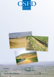
A land degradation assessment and mapping method
A land degradation assessment and mapping method A standard guideline proposal
8
2010
52 pp

Abstract

Arable land is a vital resource for humankind. Cultivation of this land generates food to meet the daily needs of the world’s population. This land is limited and the area is constantly shrinking—2 ha/inhabitant in 1900 versus 0.4 in 2010— due to the impact of human activities and population growth. Arable land is not a naturally renewable resource on the time scale of human evolution and is invaluable as it cannot be manufactured. This land therefore has to be properly managed. It is thus essential to understand the actual land degradation status so as to be able to draw up protection, restoration and/or sustainable management policies.

In 1990, the results of the first global land assessment were incomplete because of a lack of common assessment procedure. This CSFD Dossier describes a streamlined land degradation assessment method that can be applied on different spatial scales—farm to country—and in all climatic zones in worldwide.

The type, extent and degree (or severity) of land degradation are the three main indicators selected. When pooled, they represent a degradation index rating that is displayed in a simple way on maps that can be readily used by politicians, decisionmakers and the media. Complementary indicators are useful for staff responsible for implementing land degradation control initiatives in areas earmarked by decisionmakers: degradation rate and trend, historical background, soil sensitivity and resilience, possible causes, off-site effects, and rural population density.

The results obtained could contribute to meeting the objectives of the United Nations Convention to Combat Desertification, especially through national objectives in countries affected by desertification that must regularly report on land degradation.
Fighting wind erosion
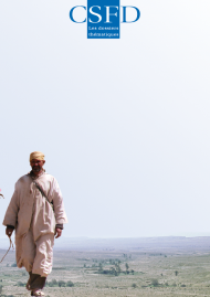
Fighting wind erosion One aspect of the combat against desertification
3
2011
44 pp

Abstract

Wind erosion—alone or combined with other physical or socioeconomic causes—is a mechanism that may induce desertification, i.e. severe or irreversible degradation of water and soil resources. Now that this phenomenon is better understood, the model of the 1970s based on three distinct stages (causes, mechanisms, consequences) has been discarded, in view of the many feedbacks and insidious links generated by wind erosion. Timely detection of wind erosion onset thresholds with remote sensing tools (satellite images and aerial photographs), and spatial delimitation and positioning of the phenomena observed are essential to be able to efficiently combat the damaging effects of wind erosion. No field operations can be effective without prior knowledge of wind erosion mechanisms at the land-atmosphere interface.

At this interface, wind activities are organised in dynamic units on a continental scale, or so-called global wind action systems (GWAS) spanning the Saharan and Sahelian regions, or regional scale (sweeping southwards across Egypt), or so-called regional wind action system (RWAS), in which humans interact via their activities. A GWAS is divided into three (particle source, wind transport, deposition) areas, each of which may be found at several locations within the GWAS.

When striving to combat wind-induced threats, especially by controlling clay, silt and sand particle loss and, conversely, sand invasion, the sediment balance and types of prevailing dunes should be taken into account, while distinguishing between the:

  • mobility in source areas where mobile particles should be stabilised
  • mobility in transport areas where wind streams should be deflected so as to prevent human infrastructures from being filled with sand, and
  • mobility in deposition areas where sand invasion is at stake.

The first stage consists of defining the site to be protected in relation to the GWAS or RWAS (taking the topography and type of dune or mobile sand into due consideration), and assessing the surface to be stabilised or protected. The second operational stage aims at reducing the surface wind velocity through technical and biological strategies.

To ensure success, the specific features of local ecosystems and human communities must be taken into consideration and effectively tapped in wind erosion control programmes in order to minimise costs and come up with solutions that are viable for the communities involved. 

Support

Editing, production and distribution of Les dossiers thématiques du CSFD are fully supported by this Committee thanks to the support of relevant French Ministries and AFD (French Development Agency).

  • Ministère de l'Education nationale, de l'Enseignement supérieur et de la Recherche
  • Ministère des Affaires étrangères et du Développement international
  • Ministère de la Transition écologique et solidaire
  • Agence Française de Développement (AFD)

Opinions

The opinions expressed in these reports are endorsed by the Committee.

Contact

CSFD
Comité Scientifique Français de la Désertification
Agropolis International
1000 avenue Agropolis
F-34394 Montpellier CEDEX 5 • France
Tel.: +33 (0)4 67 04 75 73• email: csfd@agropolis.fr